What sources do you like for historic and real-time weather and wind data?
The specific info I would be looking for in the sources would be how much of the time during the different months the wind is blowing at 10 m/s at ground level, and 100 meters up, in Europe.
And where I could get accurate real-time data, with a high resolution.
I don’t know where this topic should go.
PierreB
December 12, 2018, 10:23pm
2
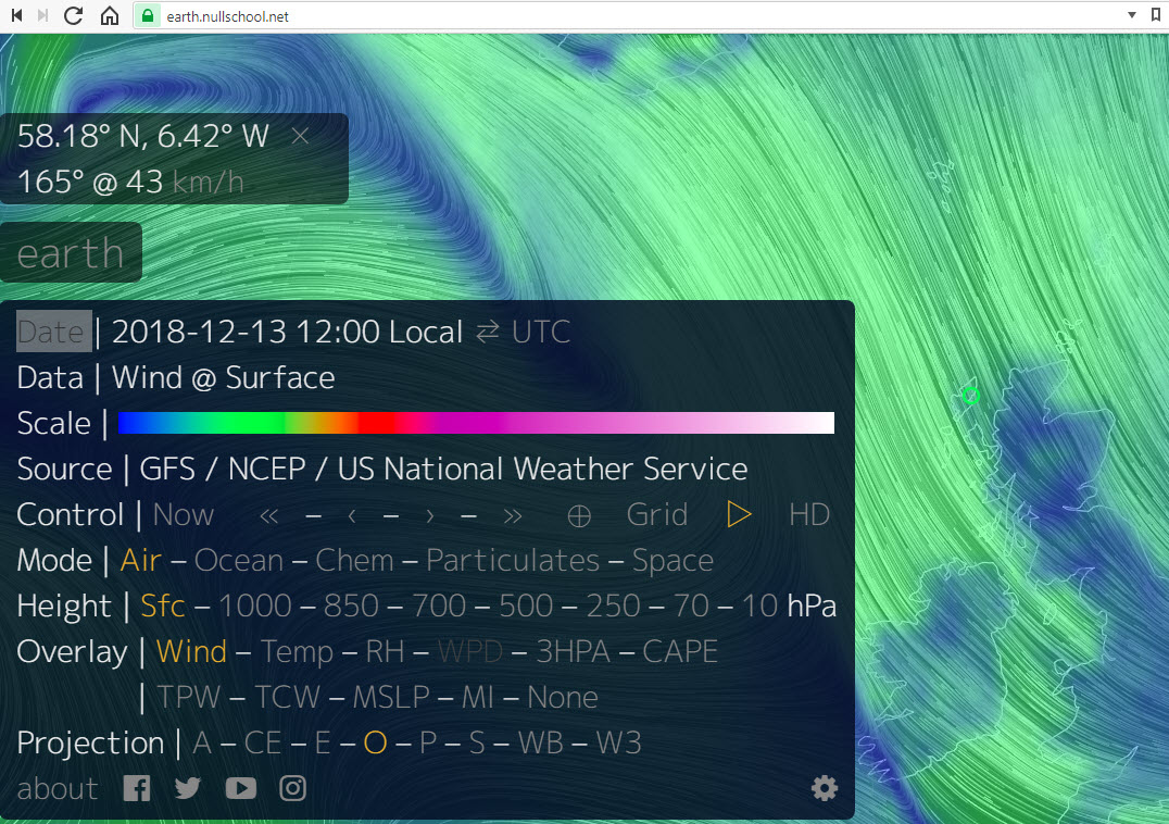
Here is Cristina Archer’s publications: http://www.ceoe.udel.edu/our-people/profiles/carcher/my-publications . Cristina Archer is involved in airborne wind energy.https://www.bgc-jena.mpg.de/index.php/BTM/LeeMiller .https://earth.nullschool.net/#current/wind/surface/level/orthographic/loc=37.493,32.278 where one clicks in any part to know the wind speed, but without data about wind in altitude.
1 Like
Tom
December 12, 2018, 10:23pm
3
Resource Analysis- would put it in Industry and Market Analysis.
Tom
December 12, 2018, 10:28pm
4
A group involving Roland Schmehl will publish on the topic.
In the github docs for this there were good sources. Needs some digging to get to them.
See current wind, weather, ocean, and pollution conditions, as forecast by supercomputers, on an interactive animated map. Updated every three hours.
1 Like
Thanks @PierreB , @Tom ! I’ll look through these.
tallakt
December 13, 2018, 6:36am
6
I believe windfinder has a means to see current wind at different altitudes
Rodread
December 16, 2018, 12:09am
7
Oh I like that site.
Windy was forecasting similar (I think- ish)
Tom
December 16, 2018, 1:57pm
8
I don’t think the tool is that exact.
METAR Data parsing and processing is kPower’s conceptual approach to mesoscale AWES weather automation, as explored over many years on the Old Forum.
METAR is a format for reporting weather information. A METAR weather report is predominantly used by pilots in fulfillment of a part of a pre-flight weather briefing, and by meteorologists, who use aggregated METAR information to assist in weather forecasting.
Raw METAR is the most common format in the world for the transmission of observational weather data.[citation needed] It is highly standardized through the International Civil Aviation Organization (ICAO), which allows it to be understood ...
1 Like
We use NREL website when preparing reports or doing research. For day-to-day current wind conditions, we use two apps that have been quite reliable. They are WindAlert and WindFinder Pro. We always cross check with the local weather forecast too. WindAlert will show up to 6 months historical data.
4 Likes
The prevailing wind in a region of the Earth's surface is a surface wind that blows predominantly from a particular direction. The dominant winds are the trends[clarification needed] in direction of wind with the highest speed over a particular point on the Earth's surface.[citation needed][dubious – discuss] A region's prevailing and dominant winds are the result of global patterns of movement in the Earth's atmosphere. In general, winds are predominantly easterly at low latitudes globally. Wi...
A wind rose is a graphic tool used by meteorologists to give a succinct view of how wind speed and direction are typically distributed at a particular location. Historically, wind roses were predecessors of the compass rose (found on charts), as there was no differentiation between a cardinal direction and the wind which blew from such a direction. Using a polar coordinate system of gridding, the frequency of winds over a time period is plotted by wind direction, with color bands showing wind sp...
https://www.enviroware.com/METAR/METAR_WindRoses_2018_maps.html
https://op.europa.eu/en/publication-detail/-/publication/a874f843-c137-11e8-9893-01aa75ed71a1/language-en
Page 70:
Stability
163 Gambier, Bastigkeit and Nippold, supra note 104 .
104 Bechtle, P., M. Schelbergen, R. Schmehl, U. Zillmann and S. Watson (2018), Airborne Wind Energy Resource Analysis,[1808.07718] Airborne Wind Energy Resource Analysis
Gambier [23] and Gambier et al. [24] present a detailed modeling framework for AWE system designs and combine this with COSMO-EU and NCEP/DOE model data for 12 locations in and around Germany [23] as well as LIDAR measurements up to 1200 m at two locations in Germany [24]. The measurements reveal strong wind shear between 200 and 1000 m altitude during night time, while during the day the wind shear is small . Lunney et al. [25] present a techno-economic study of airborne wind energy harvesting in Ireland. The high-altitude wind resource was modeled on the basis of NCEP/DOE AMIP-II Reanalysis (R-2) data which provides an updated 6-hourly global analysis of atmospheric variables such as wind and temperature with143×73 grid points in the horizontal with spacing of 2.5◦ranging from the year 1979 to the present. Yip et al. [26] use MERRA-2 data to identify possible deployment areas for AWE in the Middle East, computing also the optimal height at which the systems would operate. Emeis[6] discusses AWE systems in his outlook chapter. Only very recently the Dutch Offshore WindAtlas (DOWA) has been published, consisting of 10 years of hourly data and covering the North Sea Region on a 2.5×2.5 km grid in 17 altitude levels up to 600 m. The data has been obtained by downscaling the ERA5 reanalysis using a regional numerical weather model together with additional satellite and aircraft measurements [27].
[24] Gambier A, Bastigkeit I, Nippold E. Projekt OnKites II : Untersuchung zu den Potentialen von Flugwindener-gieanlagen (FWEA) Phase II. Final Project Report; Fraunhofer Institute for Wind Energy and Energy SystemTechnology IWES; Bremerhaven, Germany; 2017. doi:10.2314/GBV:1009915452. Projekt OnKites II : Untersuchung zu den Potentialen von Flugwindenergieanlagen (FWEA) Phase II : Abschlussbericht (ausführliche Darstellung)